
GRI Blog
GBNERR Wildfire
March 09, 2016
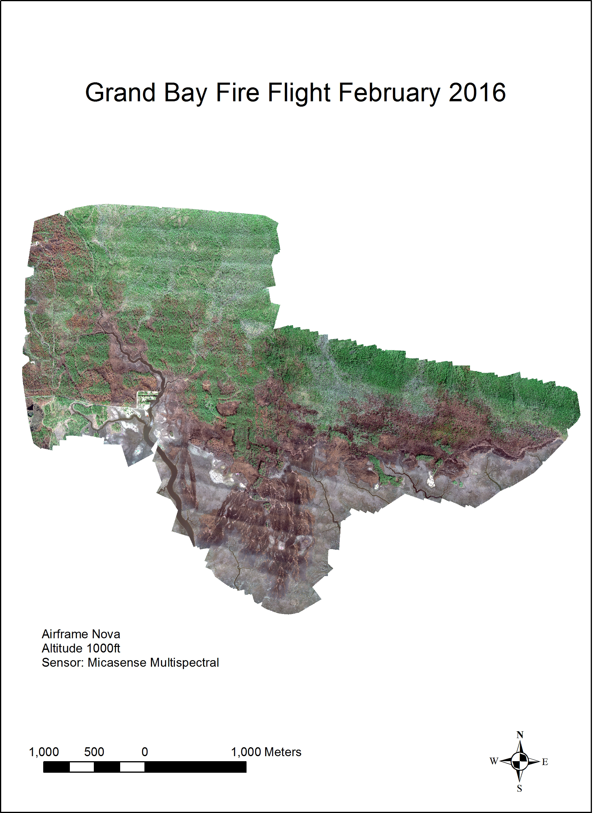
The most recent mission was flown in response to a wildfire that burned from February 11, 2016 to February 18, 2016 across 4,246 acres of marsh and upland habitat within the Grand Bay National Estuarine Research Reserve, Grand Bay National Wildlife Refuge, and adjacent lands. GBNERR wanted to obtain imagery of the fire for the purposes of mapping the effected marsh/upland habitats and analyzing vegetation regeneration. Efficient coordination between GBNERR, NGI, and GRI at MSU allowed for a mission to be coordinated quickly, funding identified, and the flight vetted through the U.S. Fish and Wildlife Service. On February 25 and 26, an Altavian Nova Block III was flown over the wildfire carrying a Micasense RedEdge payload.
Five (5) band imagery (blue, green, red, red-edge, and near infrared) of almost the entire wildfire area was obtained at 8 cm ground resolution in 3 flights. Overflights near the GBNERR headquarters, which was on the periphery of the wildfire area, were deemed too dangerous due to visibility limitations, personnel in the building, and high voltage power lines in the area.