Skip to:

GRI Blog

GRI's Amrit Shrestha Conducts Research on Cotton Yield Modeling with a Dual Mounted Micasense Payload

February 18, 2022 - Amrit Shrestha, Logan Renz, Sean Meacham
DJI Inspire 2 Photo
Amrit Shrestha, a Graduate Research Assistant with the Geosystems Research Institute and a PhD student at Mississippi State University, is currently doing research on cotton yield modeling based on remotely sensed data with machine learning technique. In the recent decade, remote sensing with unmanned aerial system especially for digital high throughput phenotyping has gained momentum due to its flexibility on revisit time and high quality of data it collects. Various research has shown that cotton yield can be estimated about 75-90 days after plantation. However, during that time period, the canopy is closed and any operation and management inside field is difficult.

DJI Inspire 2 Payload Photo
"If we can estimate yield as early as possible, we can change the management input and also enhance final yield," Shrestha said.

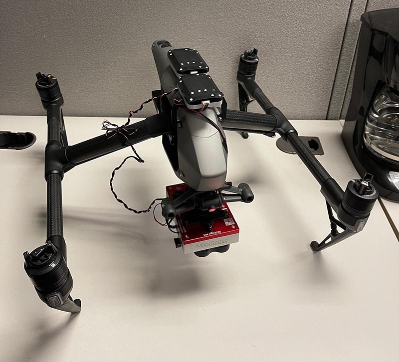
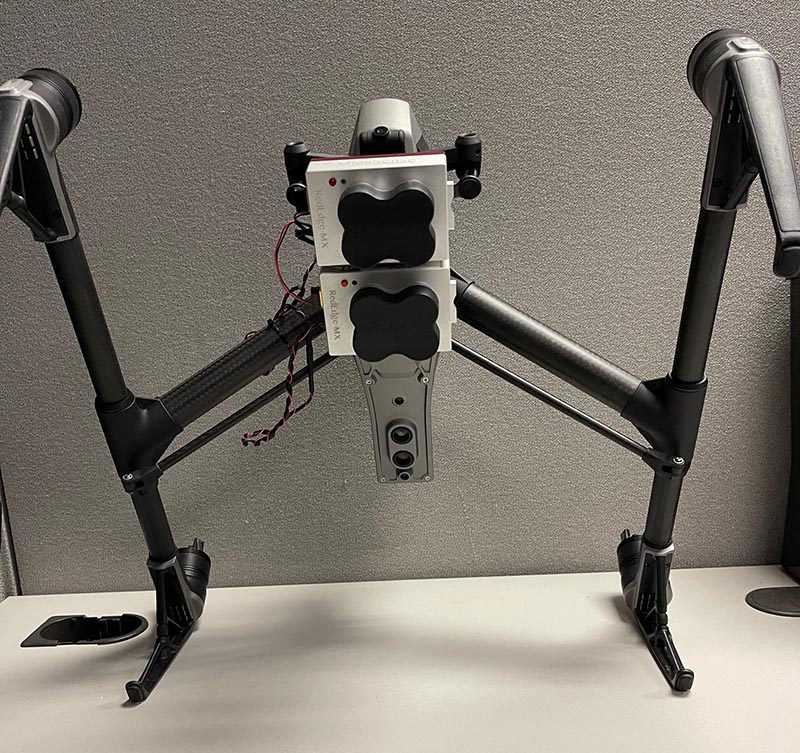
His goal is to estimate cotton yield as early as possible so farmers can make their input decision to maximize final profit. Amrit's research involved weekly flights over North Farm throughout the 2021 growing season.

Shrestha is using a DJI Inspire 2 with a dual mounted Micasense payload to compare the differences in Manual and Auto Exposure per flight.


DJI M300 - The Future Is Here
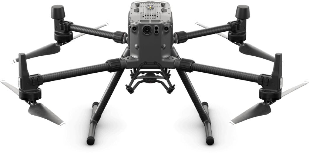
February 10, 2022 - Logan Renz, Sean Meacham
Alt text goes here
DJI M300
The latest and greatest aircraft from DJI is the M300. This quadcopter boasts a roughly 40 minute realistic flight time and emergency three motor landing feature. The two batteries required for flight weigh three pounds each to supply the 48 volt system. The transmission distance now boasts a range of around 9 miles with a max speed of 51 miles per hour. This aircraft comes with a wide angle first person view (FPV) camera. Maximum flight time without payload is 55 minutes, with maximum takeoff weight of 20 lbs the flight time is 31 minutes. The primary flight display merges real-time flight and navigation data into one integrated display.

The FPV camera now has the ability to show:
  • Speed Wheel
  • Horizontal Speed
  • Wind Speed and Direction
  • Artificial Horizon
  • Heading Indicator
  • Flight Path
  • Flight Altitude
  • Absolute Altitude
Researchers at Mississippi State University are currently using the DJI M300 with a LIDAR sensor to survey land. Other sensors that can be attached are RGB, thermal, and range finders.


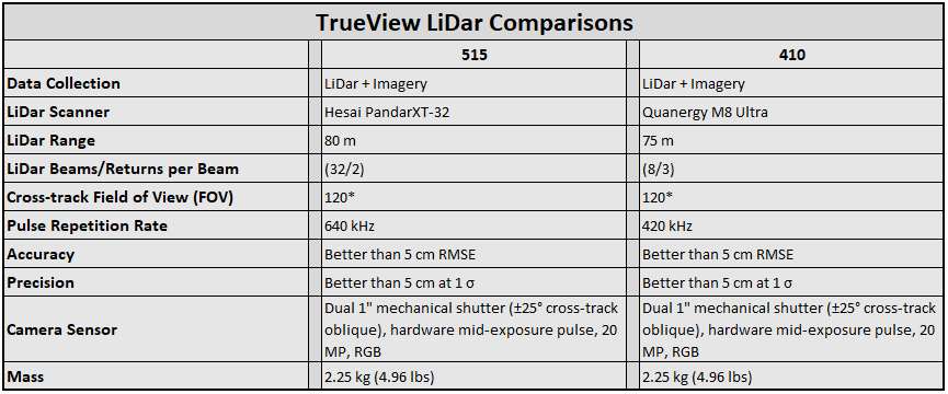
TrueView LIDAR Comparison

January 13, 2022 - Cary McCraine, Sean Meacham
The UAS team here at GRI has been using the Geocue Trueview 410 for almost two years and it has been a valuable addition to our suite of sensors. We recently acquired the Geocue Trueview 515 which is proving to be an even more robust LiDAR system for our needs. Some of the improvements from the 410 to the 515 include a faster scan rate which leads to a higher point density under the same flight parameters. It has better canopy penetration and is more sensitive to small targets such as wires and fences. While the 410 has served us well and we will continue to use it in specific cases, the 515 is opening new doors for our UAS team such as transmission line detection and increased topographical mapping abilities.

Geocue Trueview 410
Geocue Trueview 515
Figure 1. The images displayed are from a local area used for aquatic plant research that has lines draped between poles to hold shade cloth aloft. The upper image (blue) is from the 410 and the lower (purple) is from the 515. Notice the large increase in returns of the strung wires from the 515 compared to the 410.

Geocue Trueview comparison table