GRI Blog
Post-Logging Estimation of Loblolly Pine (Pinus taeda) Stump Size, Area and Population Using Imagery from a Small Unmanned Aerial System
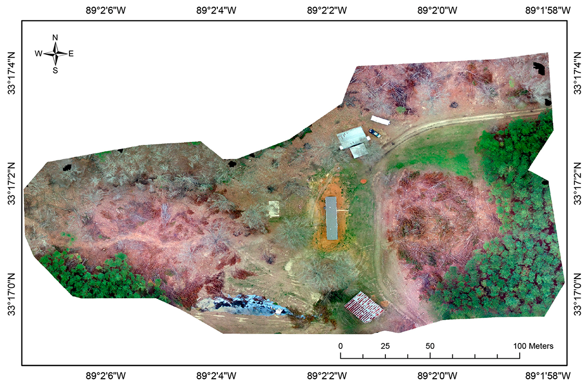
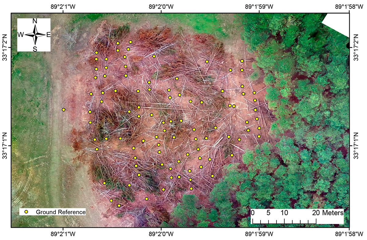
This study describes an unmanned aerial system (UAS) method for accurately estimating the number and diameters of harvested Loblolly Pine (Pinus taeda) stumps in a final harvest (often referred as clear-cut) situation. The study methods are potentially useful in initial detection, quantification of area and volume estimation of legal or illegal logging events to help estimate the volumes and value of removed pine timber. The study sites used included three adjacent pine stands in East-Central Mississippi. Using image pattern recognition algorithms, results show a counting accuracy of 77.3% and RMSE of 4.3 cm for stump diameter estimation. The study also shows that the area can be accurately estimated from the UAS collected data. Our experimental study shows that the proposed UAS survey method has the potential for wide use as a monitoring or investigation tool in the forestry and land management industries.
Timber theft is the intentional illegal harvesting of timber that belongs to someone else. Similarly, timber trespass is the unintentional harvest of another person's timber; this usually occurs while legally logging a site adjacent to where the trespass occurs. Timber theft and trespass are common problems worldwide. Both carry a civil penalty in most US states and the thief/trespasser, if caught and convicted, is usually required to pay damages in excess of the market value of the illegally harvested timber at the time the harvest occurred. The annual estimation of loss to landowners and timber companies due to timber theft/trespass is in excess of US $20 billion globally. Aside from economic loss, timber theft can also cause environmental damage from left over slash piles as they can become fuel for wildfires. Timber theft/trespass is generally very difficult to detect in remote areas, as some landowners live far from the property they own or often travel away from property they live on. Accurate assessment of the diameter and number of tree stumps due to timber theft or trespass is needed to quantify the financial value of illegally harvested timber. Tree stump diameter can be used to estimate tree height and thus timber volume. Use of ground sampling techniques to quantify stump diameter and number following illegal timber harvest may not be cost effective and can be labor intensive.
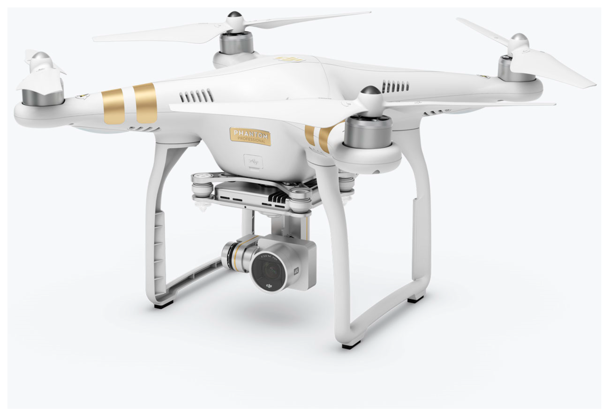
To overcome the limitations of traditional approaches we used a small unmanned aerial system (UAS) capable of collecting geo-referenceable, high spatial resolution, visible spectrum imagery; specifically, a DJI Phantom 3 Professional with a 12.4 megapixel camera. The use of UAS has been shown to be an effective tool in forest monitoring and management. As a platform, UAS are important in filling data gaps and enhancing the capability of field surveys, manned aircraft and satellites. Remote sensing based on UAS data has been shown to be effective for surveying forests, mapping canopy gaps, measuring canopy height, tracking wildfires, and supporting intensive forest management. UAS collected imagery can help with early stage identification and damage estimation of forest windthrow. Remotely sensed imagery from a UAS also shown to be effective in providing assessment of post-fire salvage logging disturbance. The use of small UAS has been shown to be helpful in tropical communities to manage and conserve forests. Very high temporal and spatial resolution imagery obtained from the UAS provide a new tool for improved forest health monitoring during disease outbreaks. With commercial availability of high spatial resolution visible and small active sensors, data can be provided for high precision forestry applications such as three-dimensional tree measurements, assessment of tree competition measurements, and growth. Remote sensing using a UAS can provide a powerful tool for estimating the abundance and diameter of tree stumps at a recently logged site. This system can negate the cost and difficulties of ground sampling while gathering needed information in a fraction of the time needed to survey a site from the ground. Imagery collected from UAS sensors is georeferenced and when used in conjunction with computer vision algorithms can potentially solve the problem of measuring forest spatial structures (i.e., tree stumps).