
GRI Blog
Geocue True View 410 LIDAR
July 07, 2020 - Cary McCraine
The LIDAR is accurate to better than 5 cm RMSE and collects three returns. This allows for some vegetation penetration to the ground beneath the canopy. Geocue's True View Evo software allows for detailed ground extraction and smoothing and can produce a number of deliverables such as RGB Orthomosaic, DEM, point clouds, and contour maps.
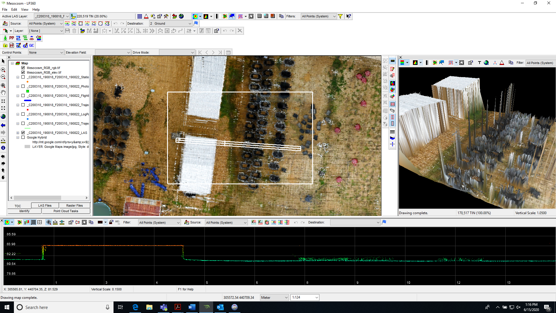
Below, you can see the RGB orthomosaic of the Mesocosm out at North Farm. The bottom window is the profile window which shows the 2D profile of a shed on the left and multiple aquatic vegetation specimen tanks on the right. The top right window is the 3D viewer window which allows you to see the lidar points in RGB or in a colormap based on height. In the 3D viewer below it is possible to see the body of the shed and the specimen tanks. The sensor is so sensitive it is possible to see the uprights which are holding shade cloth surrounding the tanks.
Mesocosm at North Farm
Field 2B at North Farm