Advanced UAS/UAV Application Systems, Data Management Systems, and Bioinformatics Tools
Surface Soil Moisture
Overview
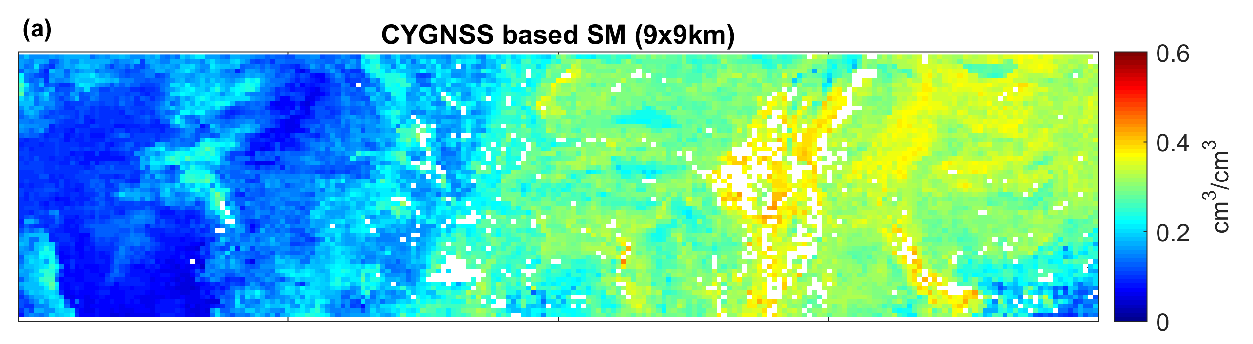
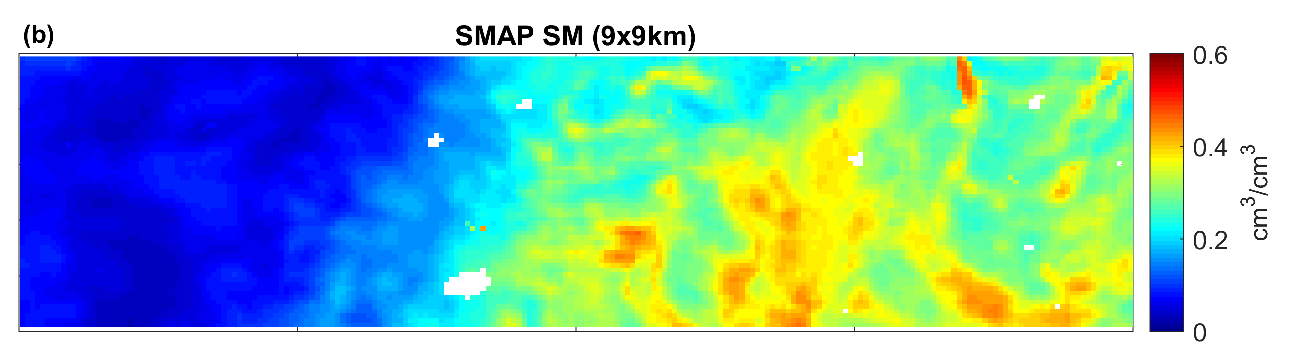
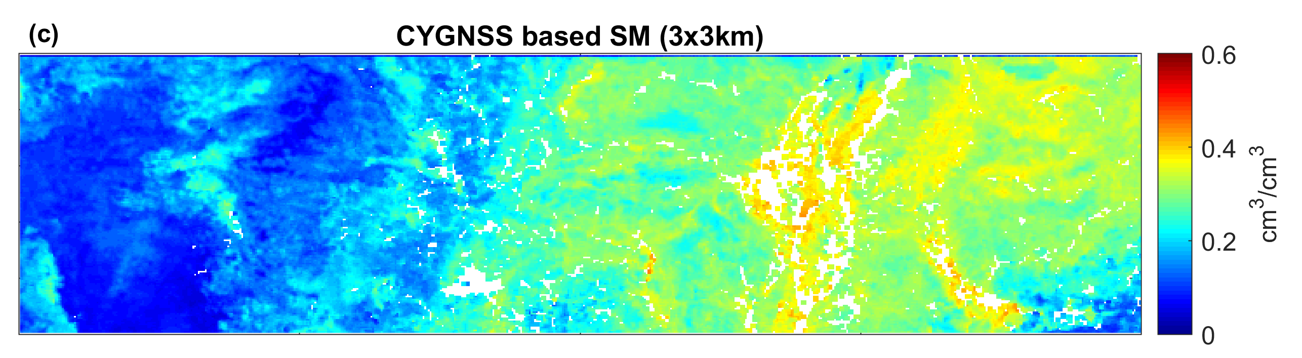
The Cyclone Global Navigation Satellite System (CYGNSS), launched in December 2016, is NASA’s first mission to perform surface remote sensing using an existing Global Navigation Satellite System (GNSS)— a satellite constellation that is used to pinpoint the geographic location of a user’s receiver anywhere in the world. Made up of a constellation of eight micro-satellites, the observatories provide nearly gap-free Earth coverage between approximately 38° N and 38° S latitude, with a mean revisit time of seven hours. CYGNSS is intended to measure the ocean surface wind field with unprecedented temporal resolution and spatial coverage, under all precipitating conditions, and over the full dynamic range of wind speeds experienced in a tropical cyclone. Through exploring the CYGNSS observables over land, we provide CYGNSS surface soil moisture products at daily 9 km resolution to complement the current CYGNSS Level 3 land geophysical dataset. More information about the CYGNSS mission is available from the PO.DAAC webpage (https://podaac.jpl.nasa.gov/CYGNSS).