
Mississippi Fire Potential Modeling
September 24, 2007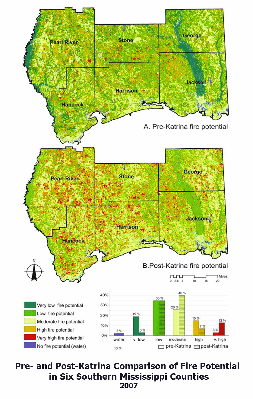 Click to Enlarge
MSU is one of only two universities featured in fire prediction research on the system's web site. MSU researchers are creating linear additive GIS models for fire potential in Mississippi and eastern states. Previous research on fire potential modeling has been focused on the western United States. The researchers have worked with the U.S. Department of Agriculture Forest Service Fire Sciences Laboratory, the Forest Inventory and Analysis unit and the Mississippi Forestry Commission to develop the modeling concepts.
The researchers are developing and testing the models for Mississippi, from which the concepts will be expanded to the entire region. They are also testing various sources for the variable data. Eventually, they hope to have dynamic regional models that include data for climate, fuels, topography, ignition and vegetation available on the system's Web site. Each variable is weighted based on its correlation to historic fire occurrence in Mississippi.
To see the research progress, check the Web site for the Wildland Fire Assessment System: www.wfas.net.
For more info contact Dr. William Cooke at whc5@geosci.msstate.edu.